
Mġarr, Malta: What to See in the Village and Around It

Mġarr is a rural village in Malta's Northern Region, set inland above the bays of Ġnejna and Għajn Tuffieħa, and it rewards a half-day rather than a full one. Come for the oval parish church, the two temple sites at Skorba and Ta' Ħaġrat, and the coastal country around it. This guide covers the village centre, those sites, the coast below, and how to get there. The local council describes L-Imġarr, as it is known in Maltese, as the most cut-off village on the island, so plan transport before you set out.
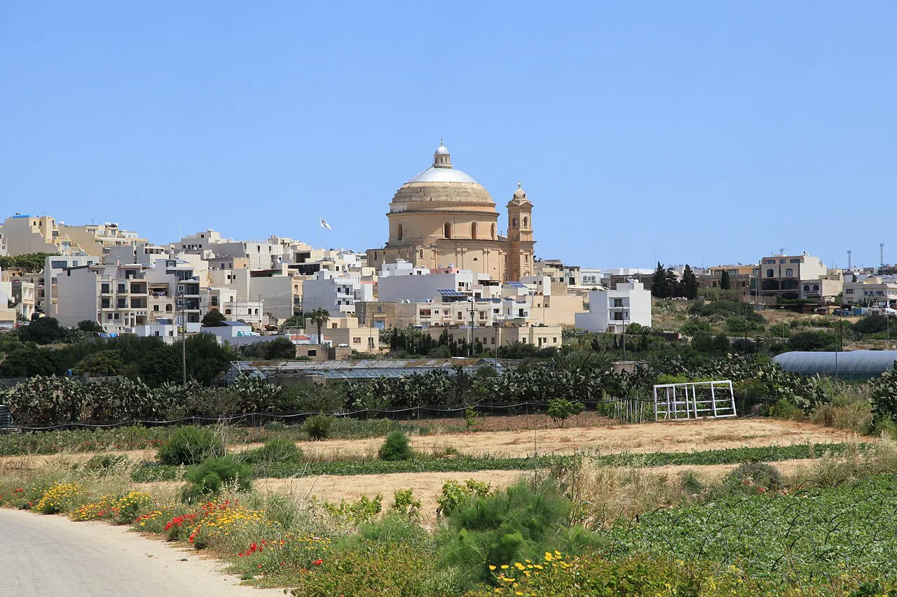
Mġarr sits in the hills west of Mosta and south of Mellieħa, with the Victoria Lines ridge forming its southern boundary. It is farmland country: the local council notes cart ruts scattered around the village. That rural setting is the point of coming, and it also means you cannot walk from one sight to the next in a few minutes.
Is Mġarr in Malta or Gozo?
Mġarr in Malta is a village in the Northern Region, inland from the coast and distinct from Mġarr ix-Xini, the inlet on Gozo. Several online guides muddle the two, and one page describes Mġarr as a Gozitan fishing village reached by ferry. If you are searching for the harbour where the Gozo ferry docks, that is Mġarr on Gozo, a different place; this page covers the Maltese village.
The confusion matters for planning because the Gozo harbour sits beside the ferry crossing, while the Maltese Mġarr sits in the hills well away from any port. Check the island before booking anything. For the villages around Mosta, our guide to the Mosta Neighbourhoods sets out how the central-northern settlements relate to one another.

The village centre: the parish church and its oval form
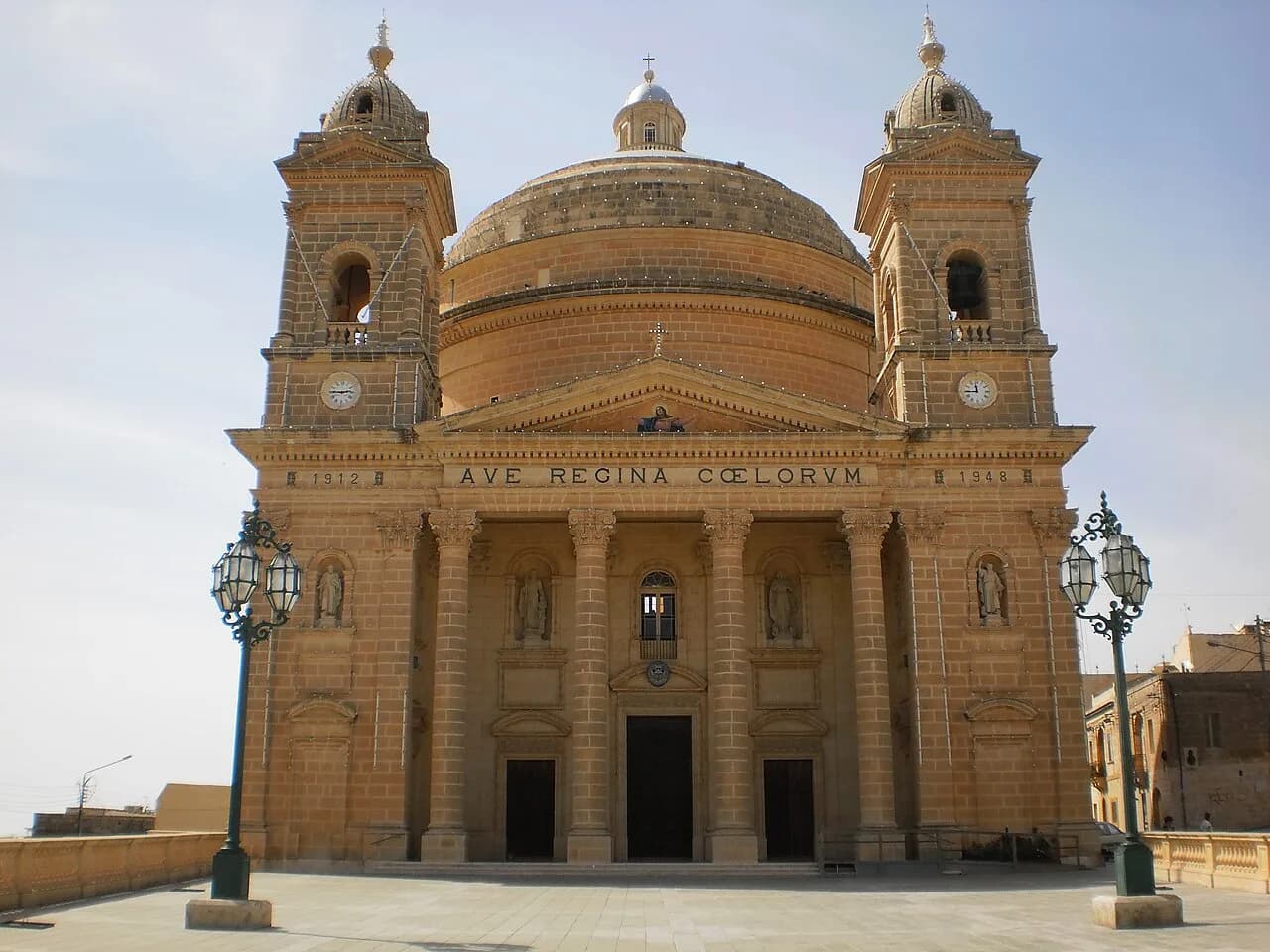
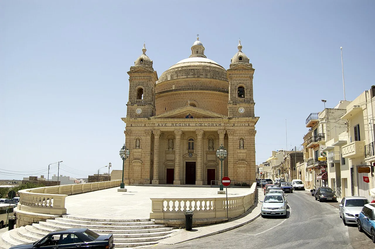
The parish church of the Assumption is the village's focal point, standing opposite the local council offices, and its plan is an oval rather than the usual Latin cross. The council records that the shape was so unusual that no architect would take on the design until Ġamri Camilleri, the village stonemason, and the Master builder John A. Cilia volunteered for the work. The same account notes that the church was funded partly in kind, with contributions including thousands of eggs and hundreds of rabbits, pigs and birds.
Mġarr became a parish in 1893, before which it formed part of the Mosta parish, and the village population at that point was around 700. Walk the streets around the church square for the village's everyday character: small houses, a few shops, and farmland starting almost immediately. Allow around an hour for the centre and the church exterior.

The temple sites at Skorba and Ta' Ħaġrat
Two separate prehistoric temple sites sit near the village, and they are distinct visits rather than one stop. The Skorba temples consist of two temples, with the western one dated to roughly 3500 BC and built on a three-lobed plan with three apsidal rooms around a central court. The eastern temple is later and less well preserved. The local council notes that some of the walls are about four feet thick.
Ta' Ħaġrat lies close to the village and also consists of two temples, the larger with a substantial facade. One tourism page dates the complex to around 2600 BC and mentions stone blocks of up to 50 tonnes, but treat that page's dates with caution given its other errors. Access arrangements and any entry charge are managed by Heritage Malta, so check its site before travelling to either temple.
Both sites are exposed, with little shade, so visit in the morning or late afternoon rather than at midday in summer. The Skorba site in particular sits in open fields, and the approach is by country road. Neither site is large enough to fill an afternoon on its own, which is why pairing them with the village and the coast works well.
The coast below the village: Fomm ir-Riħ, Ġnejna and Għajn Tuffieħa
Mġarr's coastline runs from Fomm ir-Riħ in the north-west to Għajn Tuffieħa, with Ġnejna Bay between them, and these are coastal areas you reach from the village rather than village attractions. The council describes Ġnejna and Għajn Tuffieħa as sheltered bays that once served as pirate anchorages, which is why towers were built along the cliff line. Approach them as a short drive or a longer walk from the village, and treat the descents as steep.
The Roman thermal baths near Għajn Tuffieħa formed part of a villa that included statues and amphorae, according to the council, and wealthy Roman families used the villa as a resting place on journeys to North Africa. These are archaeological remains rather than a visitor attraction with facilities, so look and move on. None of this is a beach guide: for swimming and facilities, use dedicated sources.
Torri tal-Lippija and the Victoria Lines ridge
Torri tal-Lippija was built by Grand Master Lascaris in 1657 to guard Ġnejna and the few families living at Mġarr, and it still stands on the cliff above the bay. The tower is a landmark you see from the coast roads rather than a staffed monument, so plan around the view rather than an interior visit.
The southern edge of Mġarr is formed by the Great Ridge and the Victoria Lines, a fortified wall completed in 1897, the year of Queen Victoria's Diamond Jubilee. It is marked by watchtowers, batteries, gun positions and forts, including Fort Madliena, Fort Mosta, Binġemma Fort and Fort Pembroke. Treat the ridge as landscape you pass on the road towards Mosta rather than a signposted walking attraction.
Who Mġarr suits and who it does not
Mġarr suits travellers with a car who want farmland, quiet streets and prehistoric sites without coach crowds, and who are happy to build a half-day around three or four short stops. It also suits anyone staying in Mosta or Mellieħa who wants an hour or two away from the built-up areas. The village is rural and isolated, so it does not suit anyone relying on frequent buses or on everything being within walking distance.
If you want a village with more amenities and a denser centre on the same side of the island, Naxxar is a practical alternative, and Ta' Qali covers the park and craft-village side of the area. For a broader picture of what to see in the nearest town, our guide to things to do in Mosta covers the Rotunda and the town centre.
Getting to Mġarr by bus or car
By car, Mġarr is reached from Mosta or Mellieħa on the hill roads, and a car makes the coast and the temple sites far easier because they sit off the main routes. Parking in the village centre is straightforward outside festa time. Driving also lets you combine the church, Skorba and Ġnejna in a single half-day loop.
By bus, services run to Mġarr from the main hubs, and the ride from Valletta is the slowest option; route numbers, frequencies and journey times change, so check Malta Public Transport's journey planner for the day you travel. The village is served but not frequently, and the temple sites and bays are not on the doorstep. If you rely on buses, pick one or two stops and expect to walk between them.
Eating and staying in and near the village
Mġarr is a small village, and its eating options are village-level rather than a restaurant scene: expect a handful of places around the church square and along the main street. Booking is rarely needed outside festa week. For a wider choice, Mosta is a short drive east, and the central villages of Attard, Balzan and Lija each have their own small centres worth a look.
Mġarr has little accommodation of its own, so most visitors base themselves in Mosta, Mellieħa or further east and drive in. Staying locally buys you quiet evenings and early access to the coast, at the cost of needing a car for dinner and everything else. Decide which of those you value more before booking.
Mġarr's festa: the first Sunday after 15 August
The village festa is celebrated on the first Sunday after 15 August, in honour of the Assumption, and the council describes the honour of carrying the statue in procession as one that bearers compete for with pledges and offerings. The money raised goes to charity and mission institutions, with the remainder towards church maintenance. If you are in Malta in mid-August, this is when Mġarr is at its busiest and loudest.
Outside festa week the village is quiet, and the church square and streets are a calm place to spend an hour. The council offices opposite the church keep limited public hours, so do not build a visit around them. Plan the festa as a bonus if your dates happen to fall that way rather than as a reason to schedule a trip.
Is Mġarr worth the detour?
Yes, if you have a car and half a day, and no, if you are relying on public transport to cover a lot of ground. The oval church, the Skorba and Ta' Ħaġrat temples, and the run down to Ġnejna and Għajn Tuffieħa make a coherent loop through farmland that most visitors skip. Build the day around the church square, one temple site and one bay, and leave the rest for next time.
Explore more Mosta guides
Frequently Asked Questions
How far is Mġarr from Valletta or Mosta?
Mġarr sits in the hills west of Mosta, so it is a short drive from Mosta and a longer one from Valletta. The local council describes the village as cut off from neighbouring towns, which is why a car helps. Check Malta Public Transport's journey planner for current bus routes and journey times before you set out.
Do I need to book the Skorba and Ta' Ħaġrat temples in advance?
Both sites are managed by Heritage Malta, which publishes current opening arrangements and any entry charge on its own site. Check there before travelling, because access to the smaller prehistoric sites can be limited. Neither site is large, so an hour at each is usually enough.
Can I walk from Mġarr village to Ġnejna Bay?
The bay lies below the village on the coast, and the descent is steep on country roads without a pavement for much of the way. Driving or taking a bus to the bay is the more comfortable option, particularly in summer heat. Treat the coast as a separate stop rather than an extension of a village walk.