
Mtarfa: What to See and How to Get There

Mtarfa suits travellers who have already seen Mdina and Rabat and want a quiet, uphill extension with a British military story attached. It is a residential village with a short list of sights, so plan it as half a day bolted onto a Rabat visit rather than a trip of its own. This guide covers how the village sits above Rabat, what to look for once you are up there, how to arrive without a car and how long to allow.
What Mtarfa is and who it suits
Mtarfa, also written L-Imtarfa, is a village on the ridge above Rabat whose modern shape owes much to British military building. The local council history records barracks from 1890, a hospital for wounded servicemen and a clock tower working from around 1895. It became a separate local council only in 2000, which tells you how small and recent its civic life is.
Come here if you like military-era architecture, empty lanes and viewpoints over the Rabat and Mdina plateau, and you are happy to walk uphill for them. Skip it if you want shops, a full restaurant strip or a ticketed attraction with displays. The village is quiet, and the interest is in the buildings and the setting rather than in any single sight.
The village's hinterland is farming country, and its older traces include rock-cut silos and cart ruts scattered outside the built-up area. Those are landscape details rather than signposted monuments, so treat them as context for the walk rather than objectives. If you are touring this corner of Malta more widely, the Rabat Neighbourhoods: 5 Area Guides page sets Mtarfa alongside its neighbours.

Where Mtarfa sits above Rabat and Mdina
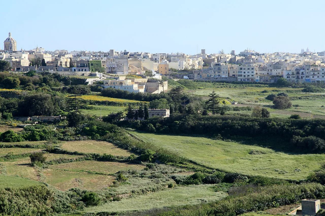
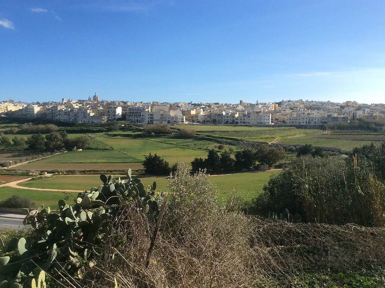
Mtarfa occupies high ground above Rabat and Mdina, a position that gives the village its character: open ground falls away while the walled cities sit below. The name is commonly explained as meaning on the edge.
Practically, that means you approach from Rabat and climb. Mdina, Rabat and Mtarfa form a triangle that the British Military Walk strings together, so you can see all three on foot in a single outing. The route is the practical frame for a Mtarfa visit, and the village works best as its final, uphill leg.
Other villages on this western side of Malta make natural pairings if you are spending a full day in the area. Dingli, Malta sits further out towards the cliff edge, and Żebbuġ, Malta lies back towards the island's centre.
The British Military Walk route through Mdina, Rabat and Mtarfa
The British Military Walk is a themed route linking Mdina, Rabat and Mtarfa, presented as a blend of historical, architectural and natural interest. Use it to give your walk a shape: start among the streets of Mdina, drop into Rabat for its churches and cafés, then climb to Mtarfa for the military-era buildings. The VisitMalta route page is the reference point for the circuit.
Wear shoes that cope with uneven stone and a steady gradient, because the Mtarfa leg is the climb of the day. Carry water in summer, when the exposed stretch between the towns gives little shade at midday. Allow the bulk of your time for Mdina and Rabat and treat the Mtarfa section as the quieter finish.
If you want to build the rest of the day around this area, Rabat Attractions bundles the churches, catacombs and museums of the town at the foot of the climb. Pick two or three of those before setting off uphill, so you are not deciding while standing in the sun.
The Mtarfa clock tower and what else to look for
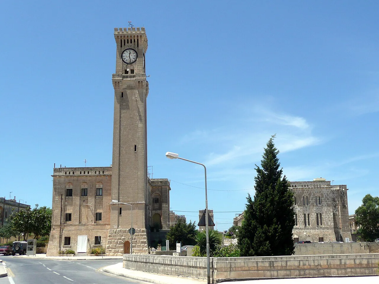
The clock tower is the village landmark and the easiest thing to navigate by when you arrive on foot. The council's local history dates it to around 1895 and notes that it was still working and in good condition after a long life, with a facelift requested from the authorities before it passed to the local council. Use it as your orientation point and work outwards from there.
Beyond the tower, look for the military-era fabric of the village: the water tank and underground rainwater reservoirs the services built, some of which the council says remain in use. These are part of the street scene rather than visitor attractions, so you will spot them by walking the lanes slowly rather than by following signs.
The chapel of St Oswald was erected within the hospital grounds for military personnel and their families, while devotion to St Lucy, patron of those with eye diseases, grew with the hospital's opening. Both are historical markers of how the village was shaped, and both help you read the buildings you pass.

The former military hospital and barracks
Work on the hospital began in 1915 and was completed by 1920, built to care for wounded personnel from the First World War. Barracks had gone up in 1890 as the military presence expanded, and a railway extension reached the edge of Mtarfa in 1883 to move local workers up the hill.
Since 1987 former military establishments have been converted for civilian use, alongside care centres, a pastoral centre and new apartments. That means you are looking at reused buildings, not a preserved garrison museum, so read them as part of a living village. There is no ticketed military attraction here, and no opening times to plan around.
How to get to Mtarfa without a car
The straightforward approach is to reach Rabat or Mdina first and walk up from there as part of the British Military Walk. Buses serve Rabat and Mdina and the towns are compact, so the practical question is the final climb rather than a separate journey. Check current routes and stops with the operator on the day you travel, since these change.
By car, the village is a short drive from Rabat and Mdina. The lanes are narrow residential streets, and arriving on foot is simpler and gives you the approach views the military site was chosen for.
Neighbouring villages in this cluster, Bahrija and Siggiewi, sit further west and south and each needs its own transport arrangement. Stringing several together in one day by bus is slow, so pick one hill village and do it properly.
How long Mtarfa needs and when to go
Give Mtarfa an hour or so on foot, added to a half day for Mdina and Rabat. The village itself is small, and its interest is spread across the clock tower, the chapels and the military-era buildings rather than concentrated in one place. Most travellers will find that enough.
Go in the morning or late afternoon to avoid the strongest heat on the climb, and avoid the middle of the day in summer when the exposed sections between the towns offer little shade. There are no seasonal opening restrictions to work around, since the sights are outdoor and public.
The village marks Mtarfa Day on 27 April, established by the local council to commemorate the month of its civic changes. Treat that as local history rather than a fixture to plan a trip around, and confirm anything you intend to attend through the council.
Where to eat and stay in Mtarfa
The council's account of Mtarfa describes a village that grew from a few hundred residents to more than two thousand, with a primary school, secondary school, police station, library and clinic. It is a lived-in residential place, so base yourself in Rabat or Mdina, where the accommodation and restaurants are, and come up for the walk.
Finish with the village lanes while the light is good, then head back down to Rabat for the evening. Book accommodation in Rabat or Mdina rather than expecting a hotel on the ridge itself.
Should Mtarfa be part of your Rabat day?
Yes, if you are already spending a day in Mdina and Rabat and want a quiet uphill finish with a British military story. Walk up via the British Military Walk, steer by the clock tower, and give the village about an hour before heading back down to eat in Rabat.
No, if you have only one day in the area and have not yet seen Mdina's streets or Rabat's churches. Do those first, and treat Mtarfa as the extra leg you add when you have time to spare.