
Delimara: Malta's Southern Peninsula, Its Fort and Inlets

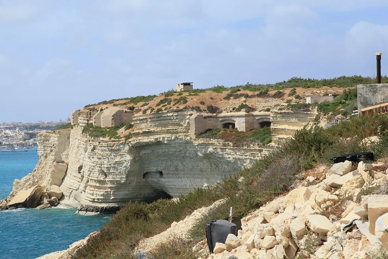
Delimara is a windswept limestone peninsula at Malta's south-east corner, within Marsaxlokk, and it rewards a half-day rather than a full one. You come for open coastline, the rocky inlet of Il-Kalanka and views of a lighthouse and a Victorian fort; you should not expect a sandy beach, cafés on the rocks or a visitor centre.
This guide covers what is actually on the peninsula, which parts you can walk to closely and which you only see from outside, then how to reach it and the practical points that decide whether the trip works for you.
Where Delimara sits on Malta's south-east coast
The peninsula runs south from the Marsaxlokk area to Delimara Point, also written Ponta ta' Delimara, which is a locality in Marsaxlokk on Malta Island. It faces open sea on its eastern side, and the Birżebbuġa shoreline lies about three kilometres west of the point, with Żejtun roughly four and a half kilometres to the north-west.
Set expectations by the landscape rather than by a brochure: this is pale rock, low scrub and big skies, with the Freeport container terminal visible offshore as a reminder that you are beside Malta's industrial south, not a resort strip. The nearest places with a village centre, shops and a harbour are Marsaxlokk and Birżebbuġa.
Nearby localities include Taqtiegħa ta' Delimara, Ponta tal-Gidien, Taħt il-Fanal and Taħt l-Irdum, names that turn up on maps but mean little on the ground; treat the point, the inlet and the fort as your three anchors.

What you will find on the peninsula
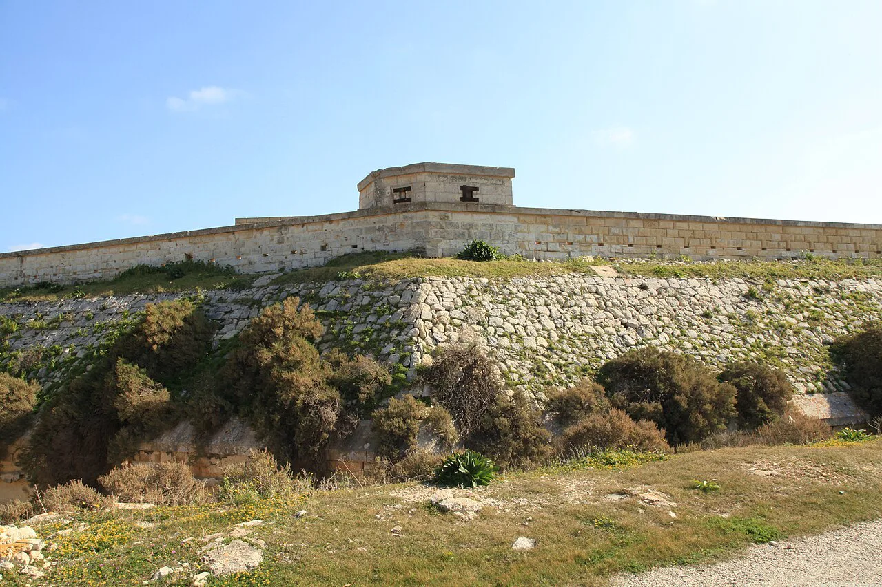
Three historic features sit around Delimara Point: the Delimara Lighthouse, an active lighthouse on the island; Fort Delimara, a polygonal fort in Marsaxlokk; and Wolseley Battery, an artillery battery in Delimara. All three are marked as places of interest at the point rather than as staffed attractions.
Between them, the peninsula is mostly open ground crossed by minor roads and tracks, so a visit is a series of short stops and a walk rather than a single site with a gate and a ticket desk. That is the appeal for some travellers and the reason others should spend the day in Valletta or Mdina instead.
A boutique hotel has been planned on the coast at Kalanka Bay beside Marsaxlokk, with green roofs, rainwater collection, electric shuttle services and parking for 42 vehicles. Its contractor describes the project as ongoing, with construction running from October 2025 to March 2027, so the peninsula's character may change during that period.

Il-Kalanka: the rocky inlet and what it lacks
Il-Kalanka is a rocky inlet on the Delimara peninsula rather than a beach: flat limestone ledges step down into clear water and give room to sunbathe and swim. It appears on maps and fishing listings under the fuller name Il-Kalanka tal-Gidien, and it sits close enough to St Peter's Pool to serve as an alternative when that spot is at capacity.
Facilities are the trade-off: there are none, so bring your own food, water and shade, because there is nothing on site. The walk in from the nearest parking area is short but crosses open, scrubby ground with no shade on the way or once you arrive, and water shoes help both on the approach and when entering the sea.
Footing needs more care than at a developed beach. It is not marked or maintained, so watch the rock ledges near the water's edge, especially with children or when the rock is wet, and go prepared to turn back if the sea is rough.
Fort Delimara: the fortress you see from outside
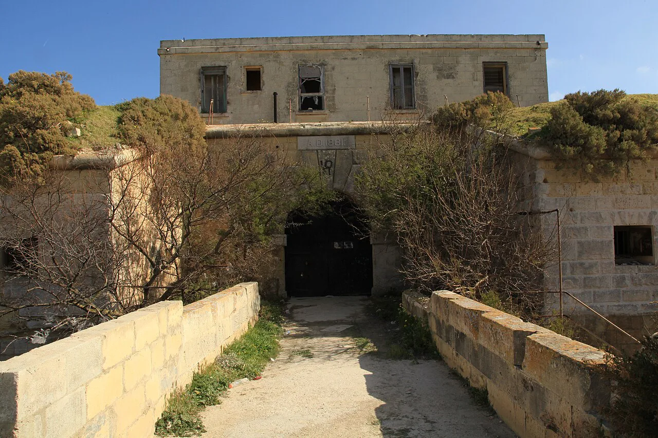
Fort Delimara, Il-Fortizza ta' Delimara in Maltese, is a polygonal bastioned fortress built by the British military between 1876 and 1888 to guard Marsaxlokk Harbour. Its thick limestone walls, dry moat, gun emplacements, magazines, barracks and underground chambers belong to that period of coastal defence, when it formed part of a chain with forts at San Luċjan and Tas-Silġ.
Access is limited and there are no formal visitor facilities or guided tours, so plan to view the fort from vantage points along the peninsula coastline rather than to walk its interior. Caution is advised near the structure because it is only partially preserved and sea-facing walls have deteriorated.
Visitors who have made the trip describe it as a place for photographs, with country landscapes, cliffs and bays around the fort rather than an organised attraction. Read that as a signal to bring a camera and sturdy shoes, and to expect wind.
The lighthouse and the surrounding coastline
The Delimara Lighthouse is an active lighthouse standing at the point, so the sensible approach is to view and photograph it from outside rather than to expect entry. Localities named Taħt il-Fanal, meaning below the lighthouse, sit nearby and give a sense of how the landmark organises the headland.
Pair a stop at the point with Wolseley Battery and the coastline itself. The southern coast here is exposed and rocky, with long sea views on one side and the harbour approaches on the other, which makes it a good place for a slow walk and a poor one for a quick swim stop unless you know the ground.
Who the peninsula suits, and who should skip it
Delimara suits travellers who have already seen Valletta, Mdina and the main harbours and want a quiet, rough-edged half-day with a camera. It also suits confident walkers and swimmers who are happy on rock with no facilities, and anyone looking for a fallback when St Peter's Pool is too crowded to enjoy.
Skip it if you want sand, sunbeds, a café, shade or a ticketed attraction with opening hours, because none of those is part of the peninsula as described. Travellers with limited mobility, small children or a tight schedule will get more from the harbour at Marsaxlokk or from Żurrieq, Malta's southern village base for the Blue Grotto, where lanes and viewpoints make a gentler afternoon. The Marsaxlokk Neighbourhoods: 5 Area Guides cover the surrounding villages if you want to weigh up a base.
Getting there and getting around
Delimara lies within Marsaxlokk, so the practical approach is to reach the Marsaxlokk or Birżebbuġa area first and continue south by road. The last stretch is on minor roads and tracks, the parking at Il-Kalanka is a short exposed walk from the water, and a car makes the short stops at the point and the fort far easier than public transport.
Without a car, treat Delimara as a single destination rather than a tour: choose one aim, such as the inlet, and walk from where you are dropped. Localities on the peninsula include Taqtiegħa ta' Delimara and Ponta tal-Gidien, but they are place names rather than stops with facilities.
Practical points: footing, shade, water and food
Plan around exposure. There is no shade on the walk into Il-Kalanka or at the inlet, so a hat, water and something to sit on make the difference, and rock ledges call for shoes with grip rather than flip-flops.
Eat before or after rather than at the inlet, since there are no facilities at Il-Kalanka to fall back on. Marsaxlokk and Birżebbuġa are the nearest places with a choice of food, and both are within a short drive.
If you plan to combine the coast with a village afternoon, the old south-east towns are close: Żejtun sits just north-west of the point, and Ghaxaq is a short drive away, which makes either a natural second stop before the light goes.
Marsaxlokk and Birżebbuġa within reach
Marsaxlokk, the fishing village that gives the peninsula its local authority, has the harbour, the restaurants and the walkable centre that Delimara lacks. Use the harbour as your base for the morning, then drive south for the rocks and the headland. Birżebbuġa is the other practical anchor on this stretch of coast, and you can read up on both in the Marsaxlokk Neighbourhoods: 5 Area Guides before you fix a base.
Birżebbuġa lies about three kilometres west of Delimara Point and is the other practical anchor on this stretch of coast, with the larger town of Żejtun a few kilometres further inland. Either makes a sensible place to refuel before or after a walk on the peninsula.
Is Delimara worth the detour?
Yes, if you want a quiet, rocky half-day with sea views, a lighthouse on the skyline and a swim at Il-Kalanka, and you accept that Fort Delimara is viewed from outside and that nothing on the peninsula is served, shaded or ticketed. No, if your day depends on sand, facilities or a formal attraction.
Build the trip around a car or a single drop-off, carry water and shade, wear shoes with grip, and finish in Marsaxlokk or Birżebbuġa for food. Confirm access on the ground before setting out, since the Kalanka Bay hotel development is still under construction.
Explore more Marsaxlokk guides
Frequently Asked Questions
Is Delimara a sandy beach?
No. Il-Kalanka on the Delimara peninsula is a rocky inlet with flat limestone ledges stepping down into clear water, used for swimming and sunbathing rather than a sandy beach.
Are there facilities at Il-Kalanka?
There are none. Bring your own food, water and shade, and expect an exposed walk in over open, scrubby ground with no shade on the way or at the inlet.
Can you go inside Fort Delimara?
Access is limited and there are no formal visitor facilities or guided tours. The fort is partially preserved and sea-facing walls have deteriorated, so it is best viewed from vantage points along the peninsula coastline.
Do you need water shoes at Il-Kalanka?
Water shoes are genuinely useful, both for the walk in over rough ground and for entering the sea over rock ledges that are not marked or maintained.