St Julian's Map: Spinola Bay, Balluta and Paceville Explained
Use this St Julian's map guide to see how Spinola Bay, Balluta, St George's Bay and Paceville connect, with walking times and the airport transfer in brief.
On this page
St Julian's is a single coastal strip running from Balluta in the south to St George's Bay in the north, with Paceville sitting inland of that last bay rather than on the waterfront. Read the map that way and most of the town sits within one continuous walk along the seafront and the streets just behind it. This guide breaks the strip down bay by bay, then covers the promenade route, buses and the airport transfer.
What the St Julian's map shows at a glance
On a map the town appears as a built-up coastal band on Malta's east coast, stretching north from Sliema, with Paceville grouped among the neighbouring districts of Pembroke, Swieqi and San Gwann. The coastline is the line that matters: Balluta at the southern end, Spinola Bay in the middle, and St George's Bay at the top with Paceville immediately behind it. Everything else on the map is residential street grid between those points.
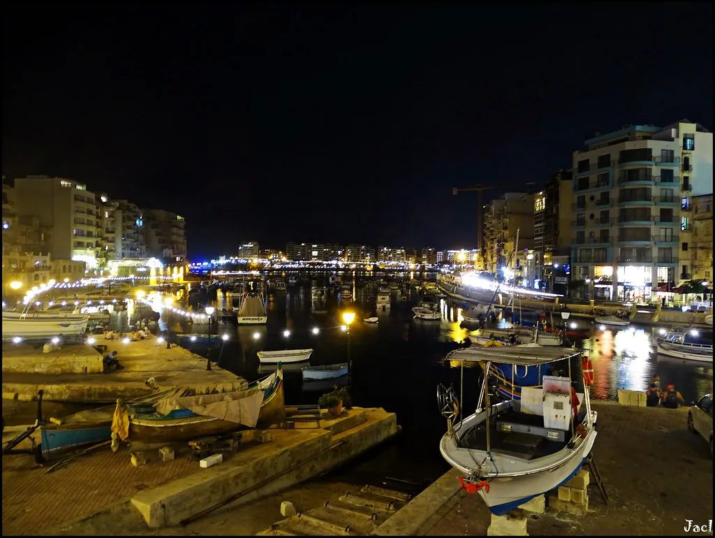
The old core still shows through. The village retains some of its old dwellings and boathouses, and the small bay still shelters coloured Maltese boats berthed there all year. Look for Spinola Bay at the centre of the strip and the tightly packed grid of Paceville just north-east of it before you start plotting a route.
Spinola Bay: the centre of the map
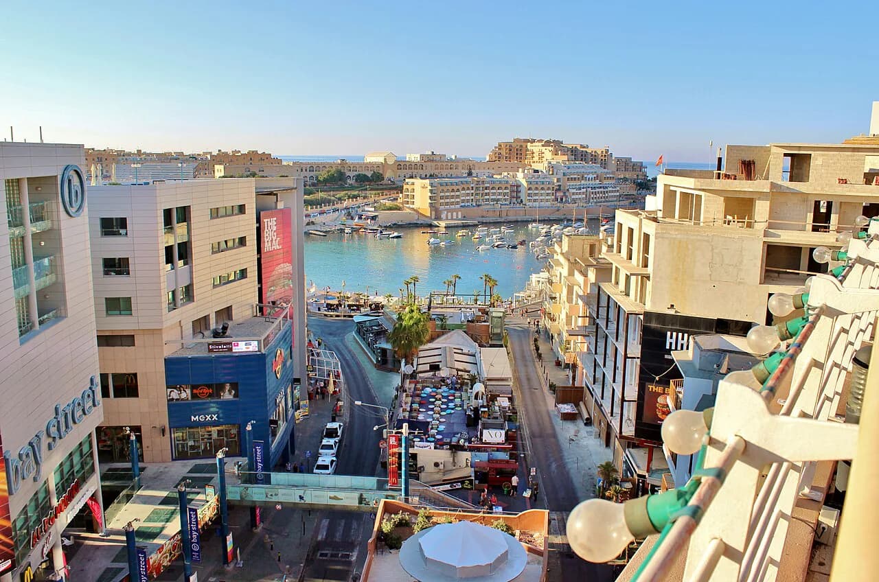
Spinola Bay is the practical anchor for orientation. It is still used by fishermen and lined with bougainvillea-clad cafés and restaurants, which makes it the obvious place to start or finish a walk and the easiest landmark to navigate back to. The waterfront here curves tightly, so the seafront road and the lanes behind it are close together and quick to cross.
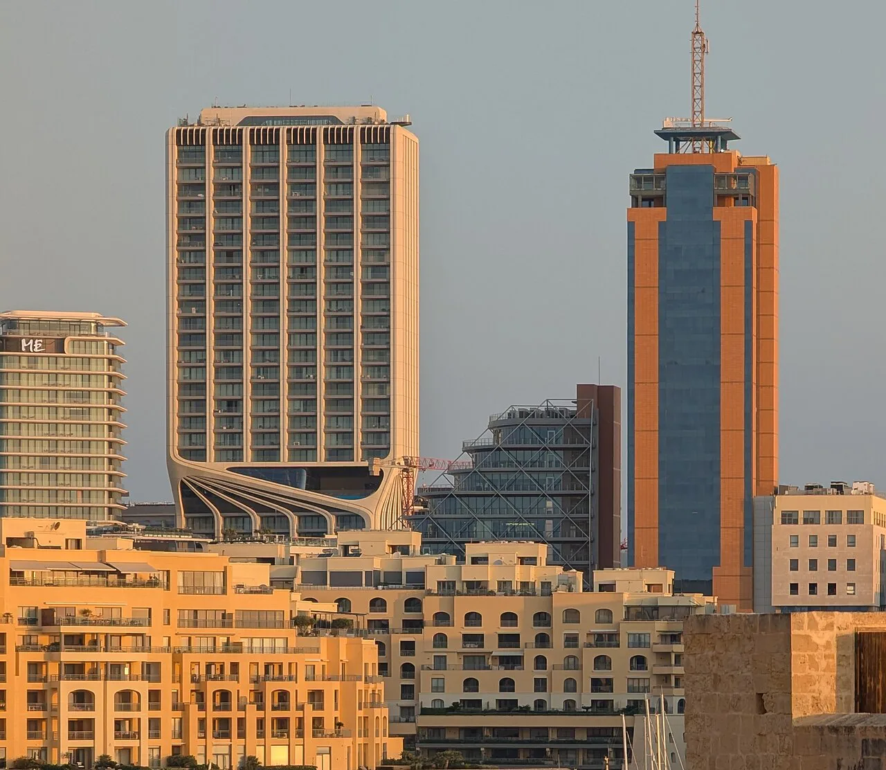
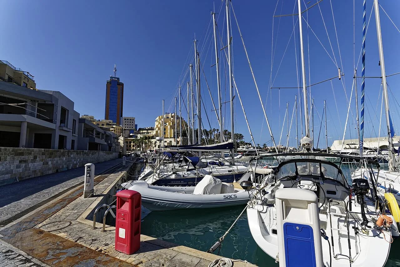
Behind the bay sits Portomaso Marina, within walking distance and the upmarket counterpart to the old fishing core, with restaurants overlooking the moored yachts. The 17th-century Spinola Palace stands nearby and is worth marking on your map as a landmark rather than a stop with a set visiting arrangement. Group the bay, the marina and the palace into one short block of your day.
Balluta Bay and Balluta Square
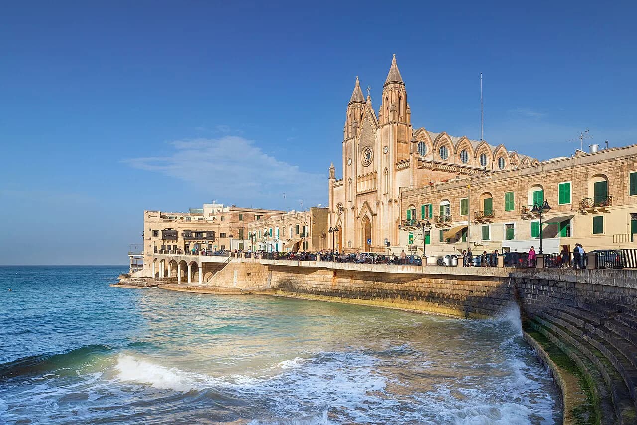
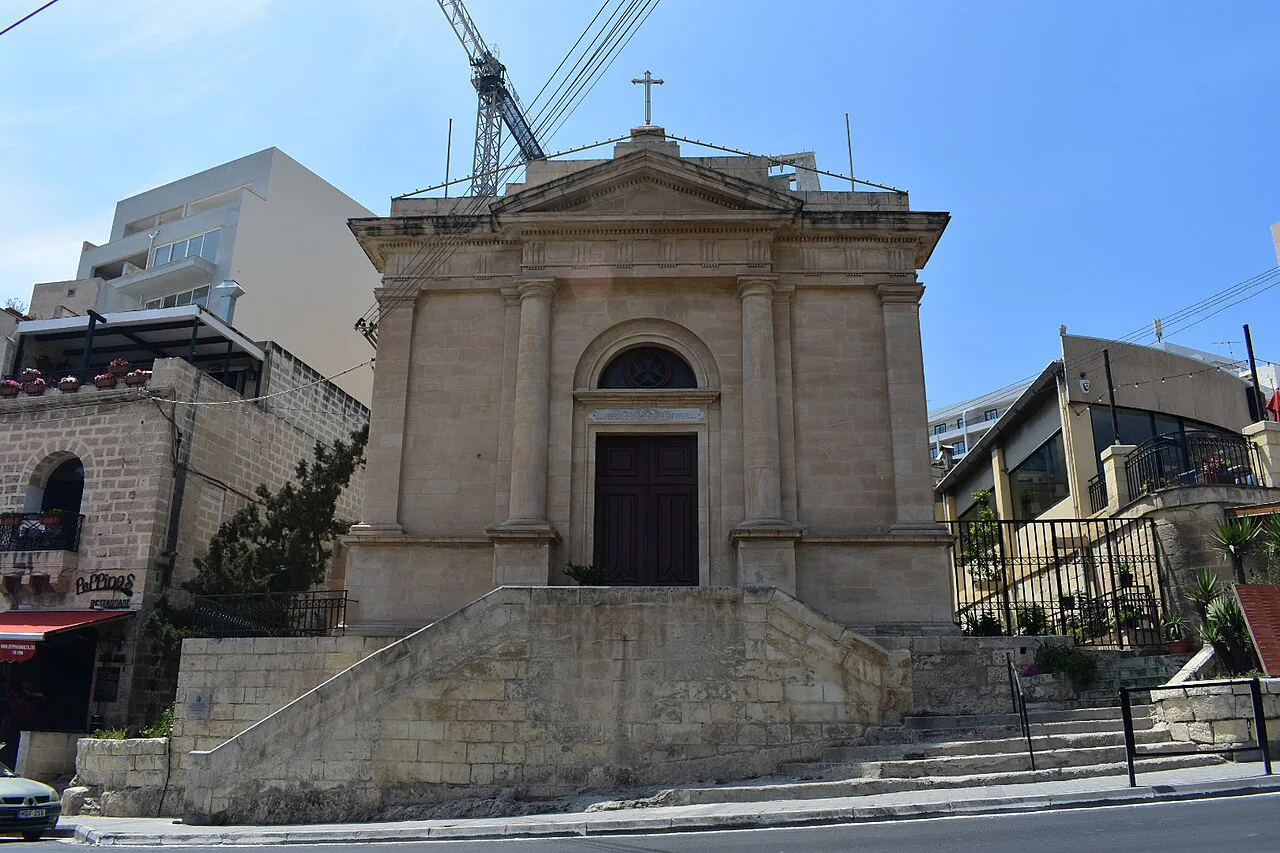
Balluta is the southern end of the strip and connects St Julian's to Sliema, so it is where a walk north from Sliema naturally enters the town. Balluta Square has restaurant terraces flanked by historic buildings, and the Church of Our Lady of Mount Carmel rises above Balluta Bay as the landmark you steer by from the water's edge. Plan Balluta as a first stop if you are arriving on foot from Sliema and as a last stop if you are working north to south.
St George's Bay and Paceville
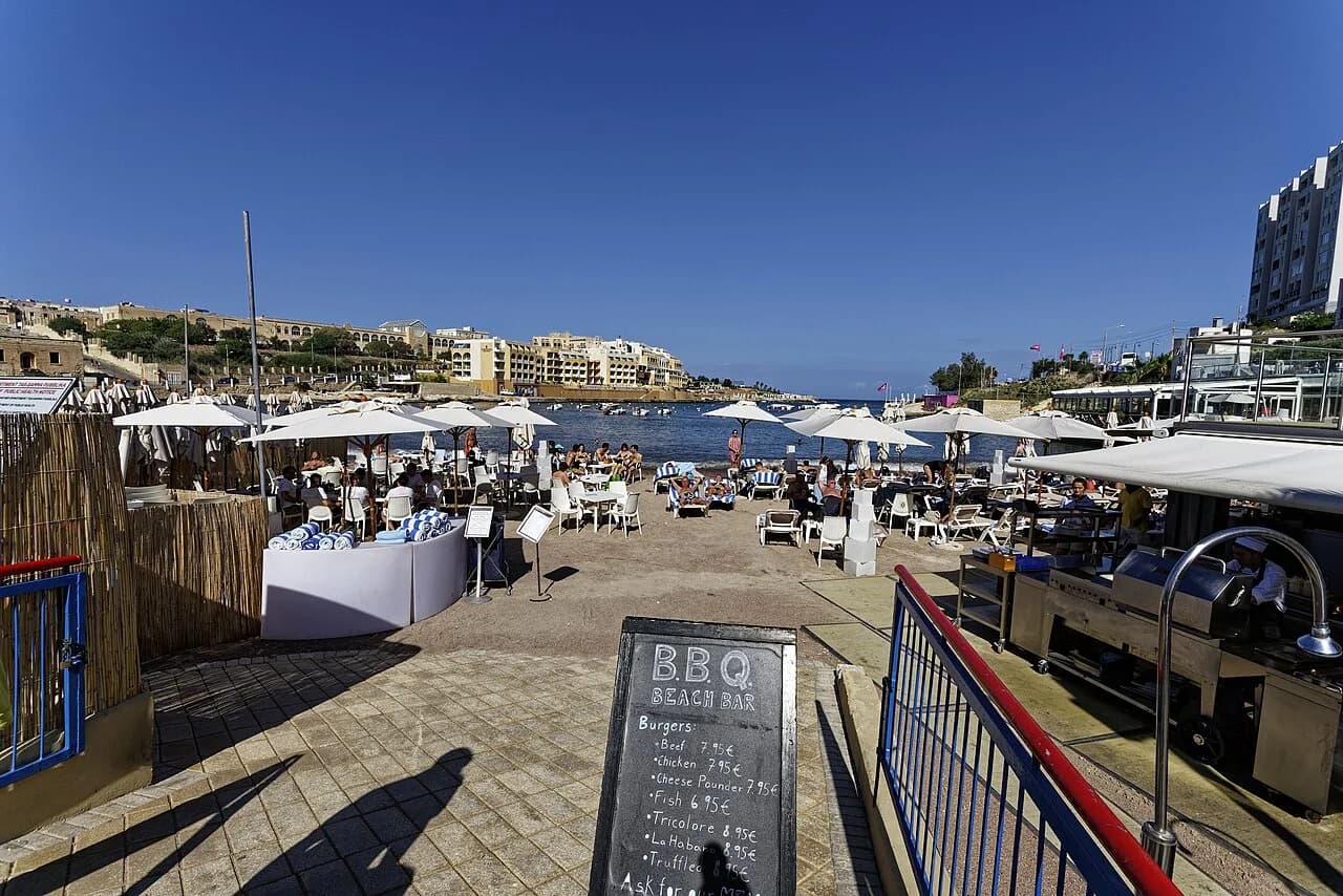
At the northern end, St George's Bay has a sandy beach backed by hotels and restaurants, and the streets immediately inland form Paceville, the district lined with bars and discos steps from the sand. Treat Paceville as its own quarter on the map rather than assuming it is separate from St Julian's; it sits inside the town and changes the character of the streets around the bay considerably. Bay Street Shopping Complex combines retail with entertainment and is the clearest indoor marker in this part of the grid.
For the shopping side of this quarter, the town has a selection of shops around Paceville and St Julian's alongside the Bay Street complex, so the retail is concentrated rather than spread across the whole strip. That concentration makes Paceville easy to plan: one compact area covers both the shops and the evening economy. If your day is mostly about browsing rather than walking the coast, base the loop here.
Walking the town: the promenade as your spine
The promenade is the simplest route through the whole town. It connects St Julian's with Sliema, and the seafront from Gzira to St Julian's is a popular stretch for walkers with views across to Valletta. Use it as the spine of any half day: walk one direction along the water, then cut inland at Spinola Bay or Paceville to see the streets behind.
Most of the town's sights sit close enough together that you can cover the strip on foot, and the promenade is the natural place to start or finish a walk. The distances between the bays are short rather than trivial, so allow for a steady pace in the heat rather than treating the map as a five-minute hop between each pin.
For a fuller menu of what to see once you are oriented, the local things to do in St Julian's span the bays and the streets between them. And when the walking is done, the best restaurants in St Julian's cluster around the same waterfront you have just followed, so you can eat without retracing your route.
Arriving: airport, buses and the Sliema boundary
Malta International Airport, also called Luqa Airport, lies about 8 km from Valletta, and journeys from it to St Julian's or Sliema take around 15 to 25 minutes by taxi. Frequent public transport also connects the airport to the main localities across Malta, so you can reach the town by bus as well as by car. That puts the whole strip within a short transfer of landing.
Once in town, regular and frequent buses serve St Julian's, and the promenade connection to Sliema puts a second transport hub within walking distance. Aim to arrive with a rough idea of which bay you are heading to, because the town's stops and landmarks are spread along the coast rather than gathered in one centre. Mark Spinola Bay as your fallback orientation point if you get off at the wrong end.
For emergencies or a pharmacy run, several pharmacies operate in St Julian's and the nearest hospital is St James Hospital in Sliema, which sits just across the boundary to the south. That is a useful pin on the map if you are staying at the Balluta end rather than the Paceville end. It is also a reminder that Sliema and St Julian's run into each other without a visible break.
Matching the map to your plan: a bay-by-bay half day
The most efficient shape for a half day on foot is a single south-to-north line. Start at Balluta Bay with the church and the square, walk north along the promenade to Spinola Bay for the fishermen's harbour and the cafés, then cut inland for Portomaso Marina and Spinola Palace before finishing at St George's Bay and Paceville. That order keeps you moving in one direction and puts the densest cluster of streets at the end, when you have your bearings.
If you only have a couple of hours, drop one end. Balluta to Spinola gives you the historic waterfront and the old core; Spinola to St George's Bay gives you the marina, the shopping and the busier streets. Deciding which end to sacrifice is the single most useful choice the map lets you make before you set out, and it saves you from zig-zagging along the coast road.
Which end of St Julian's should you start from?
Start at Balluta if you are coming from Sliema or want the calmer waterfront first, and start at St George's Bay if you are arriving by taxi from the airport and would rather finish at the cafés of Spinola Bay. Either way, keep the promenade as your spine and treat Paceville as a district inside the town rather than a separate stop.
Explore more St Julian's guides
Frequently Asked Questions
What is the postal code for St Julian's, Malta?
Postal codes in Malta are tied to individual streets and localities, and the relevant code for a specific address in St Julian's should be confirmed with the property, hotel or business you are writing to. If you are posting something, ask the recipient for their full address with the code rather than relying on a town-level guess.
How long is the transfer from Malta airport to St Julian's?
Journeys from Malta International Airport to St Julian's or Sliema take around 15 to 25 minutes by taxi. Public transport also connects the airport to the main localities across Malta, so allow extra time if you are travelling by bus rather than pre-booked transfer.
Which is better, St Paul's Bay or St Julian's?
That depends on whether you want a coastal strip you can cover almost entirely on foot. St Julian's packs Balluta, Spinola Bay, Portomaso and Paceville into one continuous walk connected to Sliema, while St Paul's Bay sits on the north coast and suits a different kind of trip. If walking between bays is your priority, St Julian's puts more within reach without transport.
Sources
Notes for your Malta trip
Optional updates when we add or correct a Malta or Gozo guide.
You might also like
Continue reading
More guides you'll find useful