Mellieħa Map: How the Village, Bay and Nearby Sights Fit Together
A Mellieħa map in words: the hilltop village, the bay below it, and how the two connect on foot, by bus or by car before you set out.
On this page
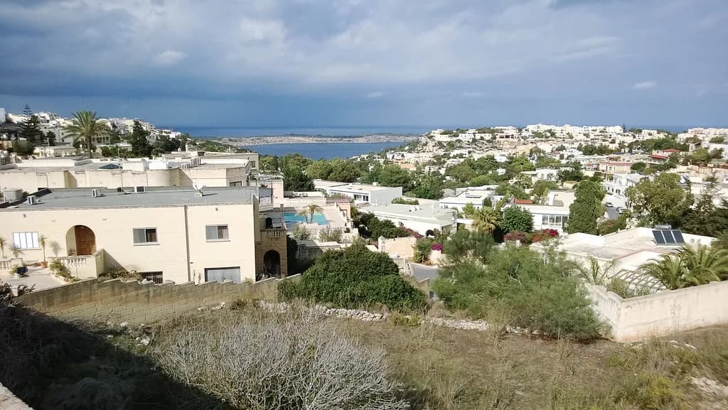
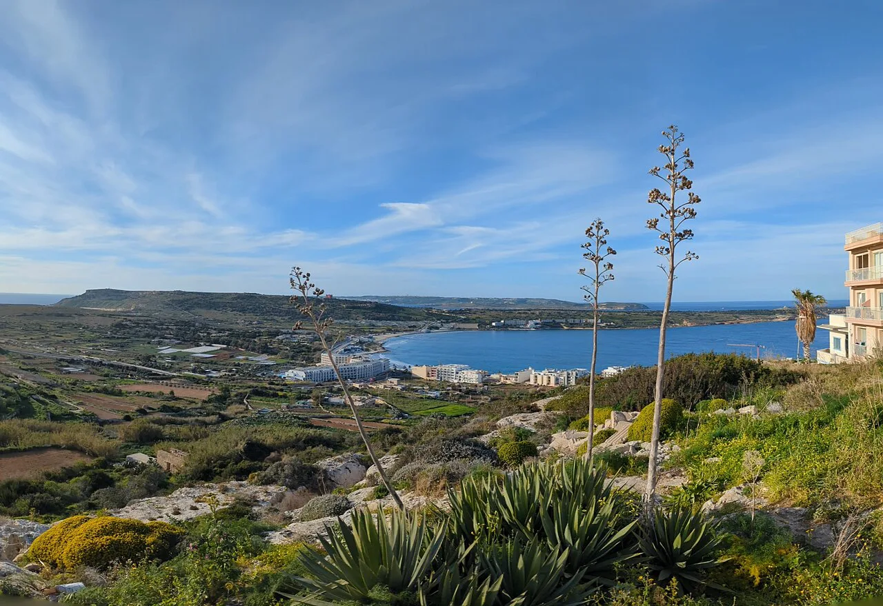
A Mellieħa map is really two centres joined by a slope: the village sits on a hilltop, and Għadira (Mellieħa Bay) lies at the foot of it. Read the map that way and the layout makes sense: the church and square up top, the bay and its road below, and the coast road running north to Ċirkewwa. This guide describes that layout in words, then covers how the hill and the bay connect, where buses and cars fit in, and the mistakes worth avoiding before you set out.
What a Mellieħa map shows you: a hilltop village and a bay below it
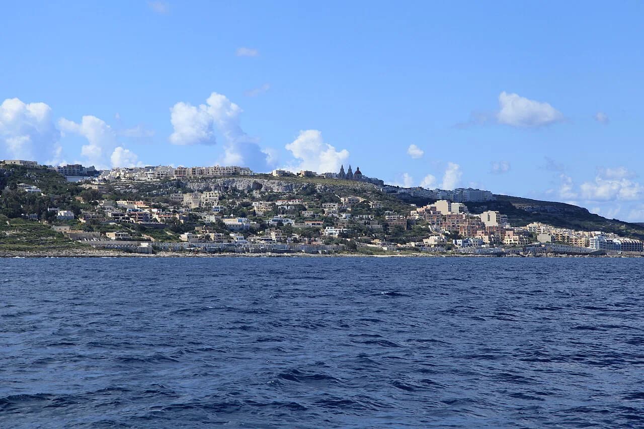
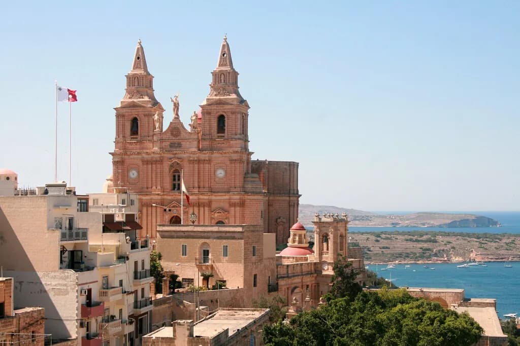
Mellieħa is a village in the north-western part of Malta, and the settlement itself is on high ground overlooking Mellieħa Bay. That single fact explains most of what a map shows: a compact core of streets around the parish church on the hill, and a separate strip of coast at the bottom. Treat the two as different destinations when you plan a day, because getting from one to the other is a walk with a gradient, not a stroll across a square.
The local name for the bay is Għadira, and you will see it on signs alongside Mellieħa Bay, so match both when you read a map or ask directions. Away from the core, the surrounding area is rural, with valleys and scattered bays rather than a continuous built-up front. That emptiness is useful to know: the map has fewer roads than you might expect, and the ones that matter are the village streets, the bay road and the coast road north.
The village core: church, square and streets on the hill
Start any walking plan at the parish church, a baroque building from the late nineteenth century that dominates the village centre. The square in front of it is the natural orientation point: from there, the streets of the old core run off downhill in several directions, and the slope is immediately obvious underfoot. Give the church and square a look first, then pick one direction rather than trying to loop the whole village.
The village centre holds restaurants, small shops and a few hotels, so it works as a base for a meal or a coffee between sights rather than a single attraction. Because the streets are steep and stepped in places, plan your circuit to end downhill where you can, or allow extra time for the climb back. If you are choosing where to eat after the walk, the Mellieha restaurants guide covers the options near the core.
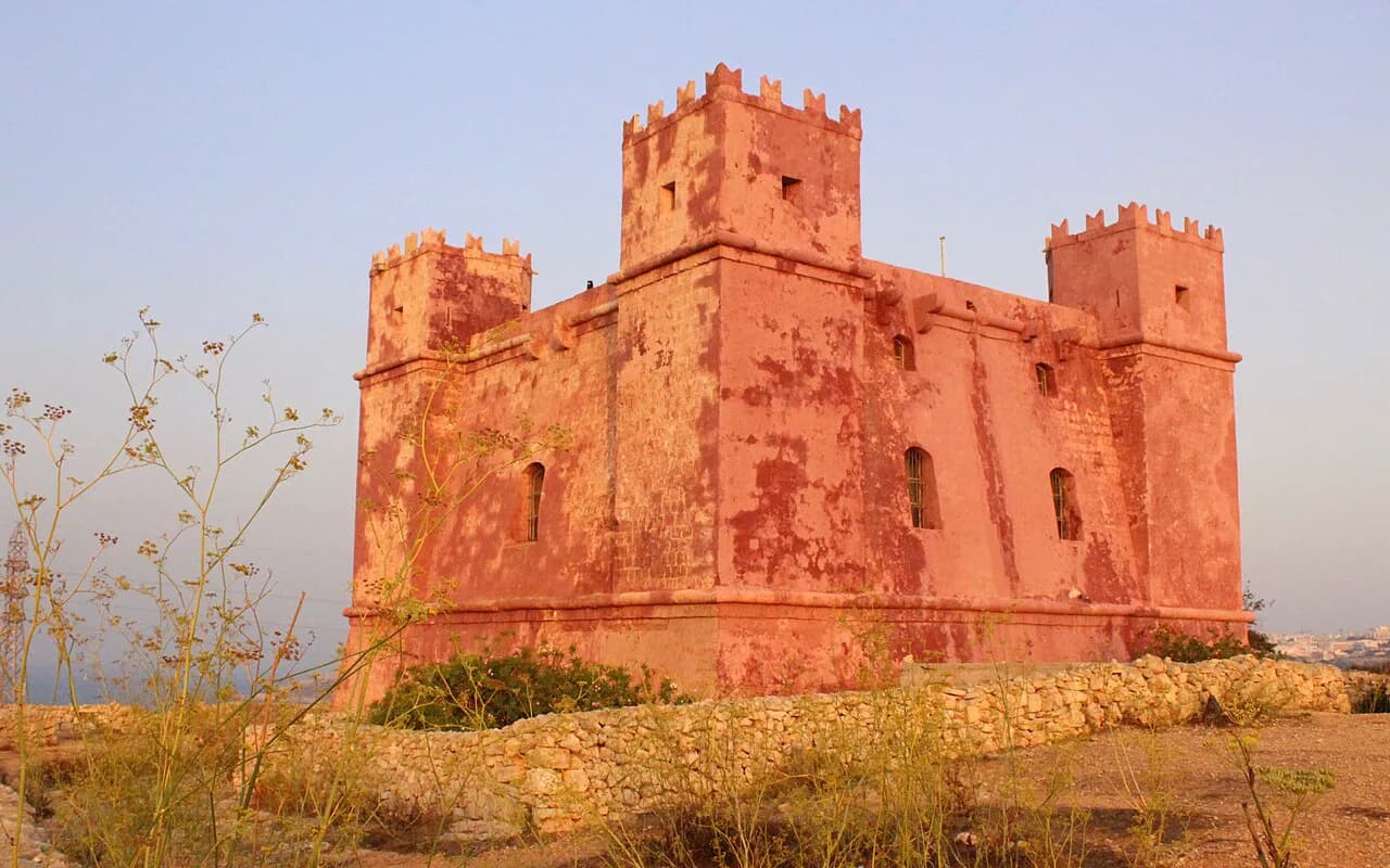
Beyond the core, the village is small enough to cover on foot, so a map is mostly about knowing which lane leads where rather than measuring long distances. The Sanctuary of Mellieħa is one of the named places of interest in the village, and the parish church is the other anchor of the centre. Mark both on your mental map and the rest of the core falls into place around them.
Għadira (Mellieħa Bay) at the foot of the village
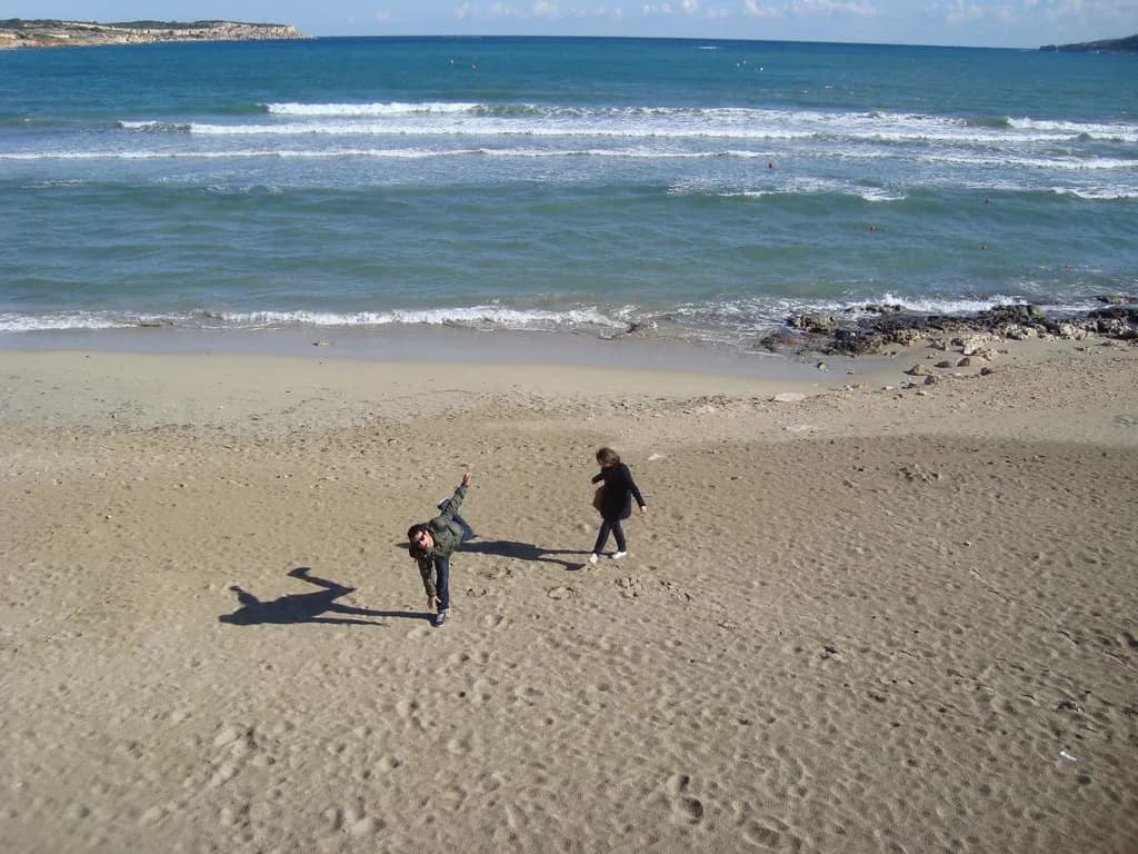
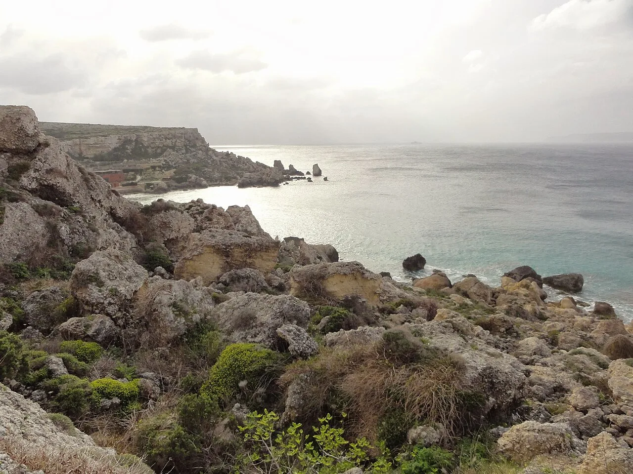
Għadira, or Mellieħa Bay, is the coastal half of the map: a sandy bay below the village with its own road and seafront. It is a separate place from the village core, not a quarter of it, so plan the bay as its own stop rather than expecting to drift down to it from the church square. The name Għadira refers to the nature reserve inland of the bay, which is worth knowing when you read local signs.
For orientation, the bay is the low point of the map and the village is the high point, with the road between them doing the climbing. If you are driving, the bay road is the straightforward approach; if you are walking, expect the return leg to the village to be the effortful part. Keep the bay as a first or last stop of the day so you are not climbing back up in the middle of a sightseeing circuit.
How the hill and the bay connect: steps, uphill walks and driving
The village sits on top of a hill, and the streets are not level, with plenty of steps and uphill walking between the core and the lower roads. That is the single most useful thing a map tells you here: the distance looks short, but the gradient decides how long it takes. Build the climb into your plan, especially in the middle of the day, and wear shoes that cope with steps.
Driving between the village and the bay removes the climb but adds parking to your plan, and the village streets are tight enough that you should ask your accommodation about parking before you arrive. Around Mellieħa the roads are quieter than in the busier parts of Malta, so driving itself is not the hard part. The trade-off is simple: walk for the atmosphere and the steps, drive for the bay and the coast road north.
Getting in: bus and car, and why a car helps in this part of Malta
Mellieħa is about an hour's drive from Malta International Airport, which tells you the village is at the far northern end of the main island rather than on the doorstep of the airport or Valletta. Public transport reaches the village, but the area is remote enough that a car makes the surrounding sights and the coast road much easier to combine. If you are relying on buses, plan fewer stops per day and accept that the bay and the village may need separate trips.
The village is one of the northernmost on the main island, so a map of Malta shows it near the top edge, with the coast and Ċirkewwa beyond it. That position is the reason to group Mellieħa with the north of the island rather than with Valletta or the south. Once you see it that way, the rest of the map, including the road to the ferries, falls into a logical order.
Ċirkewwa and the Gozo and Comino ferries, a short drive north
Ċirkewwa, the northernmost point of the main island, is a short drive from Mellieħa, and the ferries to Gozo and Comino leave from there. That proximity is the practical reason to put Mellieħa on your map at all if you plan a day on either island: you can base yourself in the village and reach the ferry terminal quickly. Check the current ferry times and ticket arrangements with the operator before you set out, as they change by season.
On a map, the route north is simple: follow the coast road from the Mellieħa area to the terminal, with no complicated turns to memorise. The catch is timing rather than navigation, so leave a buffer for the drive and for loading at the terminal. If Gozo or Comino is the main event of your day, treat Mellieħa as the staging point and keep the village and bay for another day.
Using the map before you arrive: parking, steep streets and steps
Before you arrive, decide how you will move between the village and the bay, because that choice shapes the whole day. If you have a car, confirm parking with your accommodation in advance, since the village streets are steep and not designed for casual stopping. If you are on foot, plan a route that ends downhill and keep the number of climbs to one or two.
Use the map to group sights by height rather than by distance: the church, square and Sanctuary sit in the core, while the bay and the coast road sit below. A short list of things to do in Mellieha will help you rank them before you plot them, so you are not zig-zagging up and down the hill. Book any timed visits before you travel, because the day's shape depends on when you need to be at a given place.
Common map mistakes: assuming the village and the beach are one place
The most common mistake is treating Mellieħa as a single seaside spot where the church, the beach and the restaurants sit together. They do not: the village is up on the hill, the bay is below, and the two are joined by steep streets and steps. Once you accept that, your map reading improves and you stop underestimating the walking.
A second mistake is assuming the village is a quick stop on the way to somewhere else. In practice, the hilltop core, the Sanctuary and the bay take time to link together, and the drive to Ċirkewwa adds another leg. If you want an honest view of whether the detour earns its place in your itinerary, read is Mellieha worth visiting before you commit a day to it.
Which part of Mellieħa should you map first?
Map the village core first, then the bay, then the road north to Ċirkewwa, and you have the whole area in the right order. If you have a car, use it for the bay and the ferries and walk the core; if you are on buses, pick one half of the map per day rather than trying to do both. Either way, build the hill into your timings, because the climb is the detail a flat map hides.
Explore more Mellieha guides
Frequently Asked Questions
Is Mellieħa village the same place as Mellieħa Bay?
No. Mellieħa village sits on a hilltop, and Għadira, also called Mellieħa Bay, lies at the foot of it. They are separate places joined by steep streets and steps, so plan them as two stops rather than one.
Do I need a car to get around Mellieħa?
Buses reach the village, but the area is remote and a car makes the bay, the surrounding sights and the road to Ċirkewwa much easier to combine. If you drive, confirm parking with your accommodation before you arrive, as the village streets are tight and steep.
Sources
Notes for your Malta trip
Optional updates when we add or correct a Malta or Gozo guide.
You might also like
Continue reading
More guides you'll find useful