Mdina Map: How the Silent City Is Laid Out for Visitors
A visitor's map guide to Mdina: how the walled city is laid out, where the main gate and squares sit, and how to read its streets before you walk in.
On this page
A Mdina map is best read as a walking tool, not a route planner: the walled city is compact, entered through its gates, and you can cross it on foot in a single loop. This guide lays out where Mdina sits on the island, how the gate, main street, squares and wall viewpoints relate to each other, and where buses and cars stop outside.
Mdina stands on high ground in the centre of Malta, and the Malta Tourism Authority describes the old capital as a walled city whose timeless beauty has drawn visitors for generations. Its layout rewards a slow walk rather than a checklist.
What a Mdina map shows: a walled city in the centre of Malta
On a map of Malta, Mdina sits inland from the coast, roughly in the middle of the island and well away from the harbours around Valletta. The city is enclosed by fortifications, so every approach ends at a gate rather than an open street.
The settlement is small in plan, which changes how you use a map here. Treat the map as a way of finding the gate, the main street and the wall edges rather than as a way of measuring long walks between sights.
Historic plans of Mdina held by the National Archives of Malta show its internal layout and fortified form, which helps explain why the street pattern inside the walls is so tight.

Start at the main gate: Mdina Gate as the usual arrival point from Rabat and the bus stops
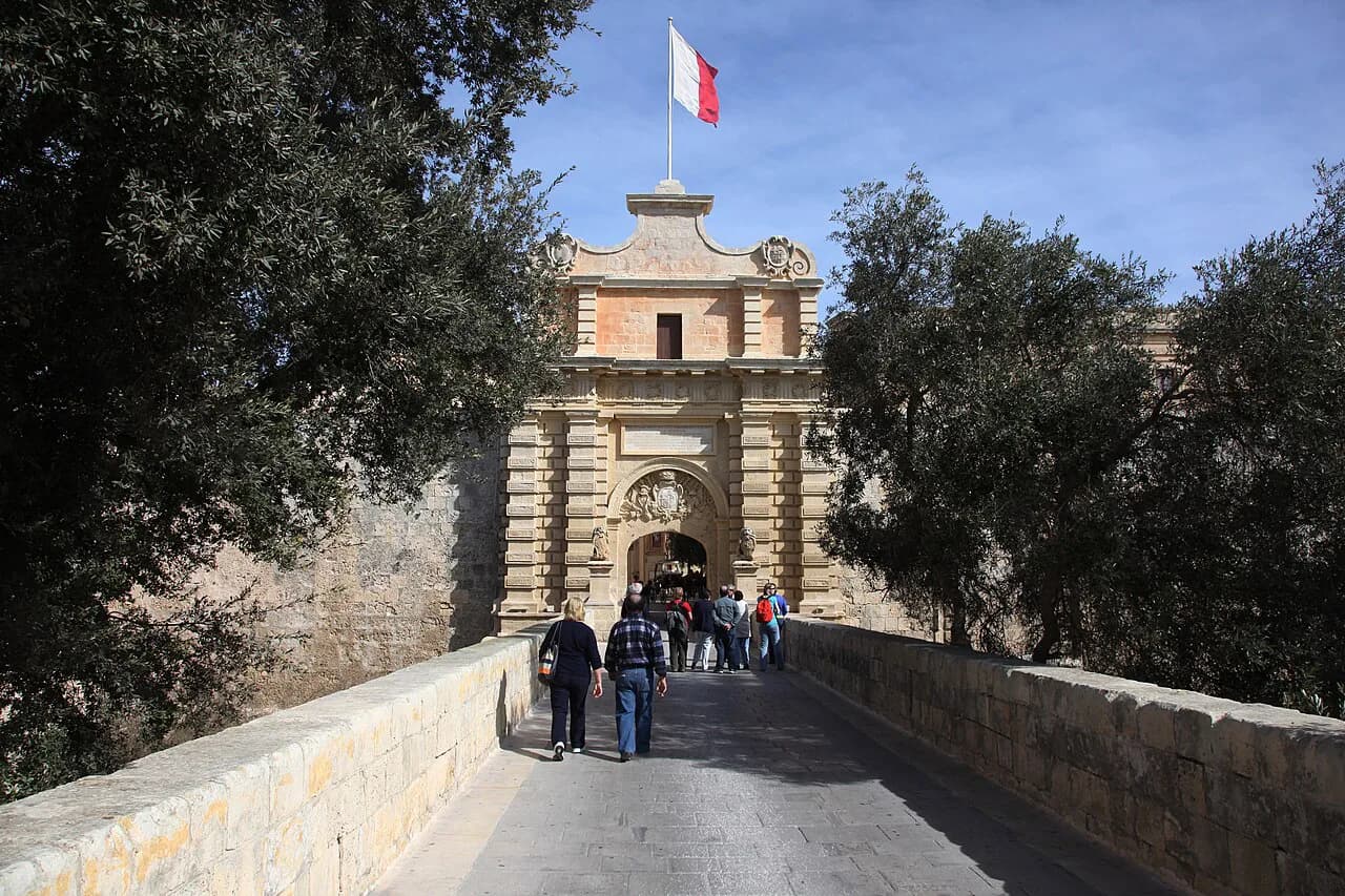
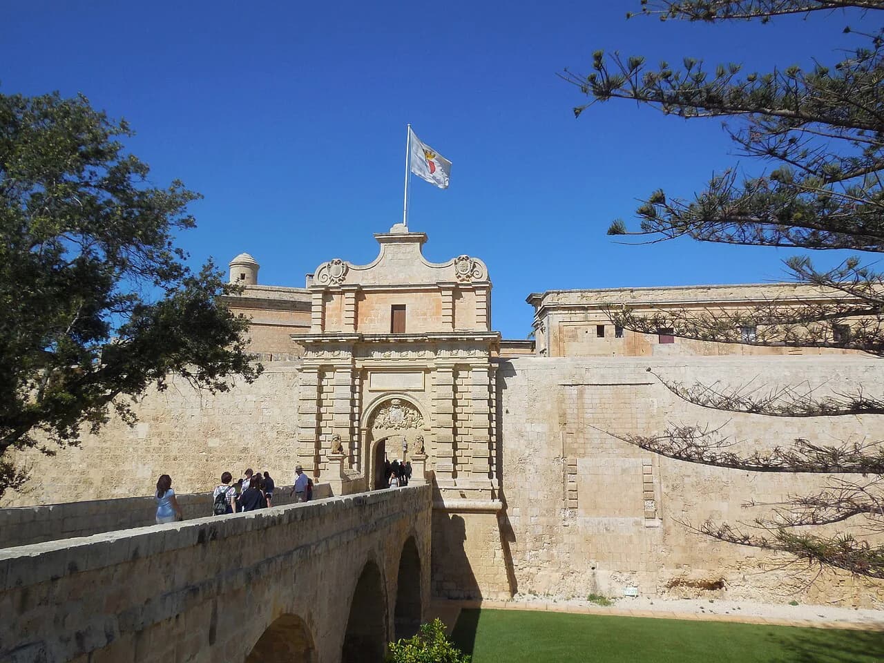
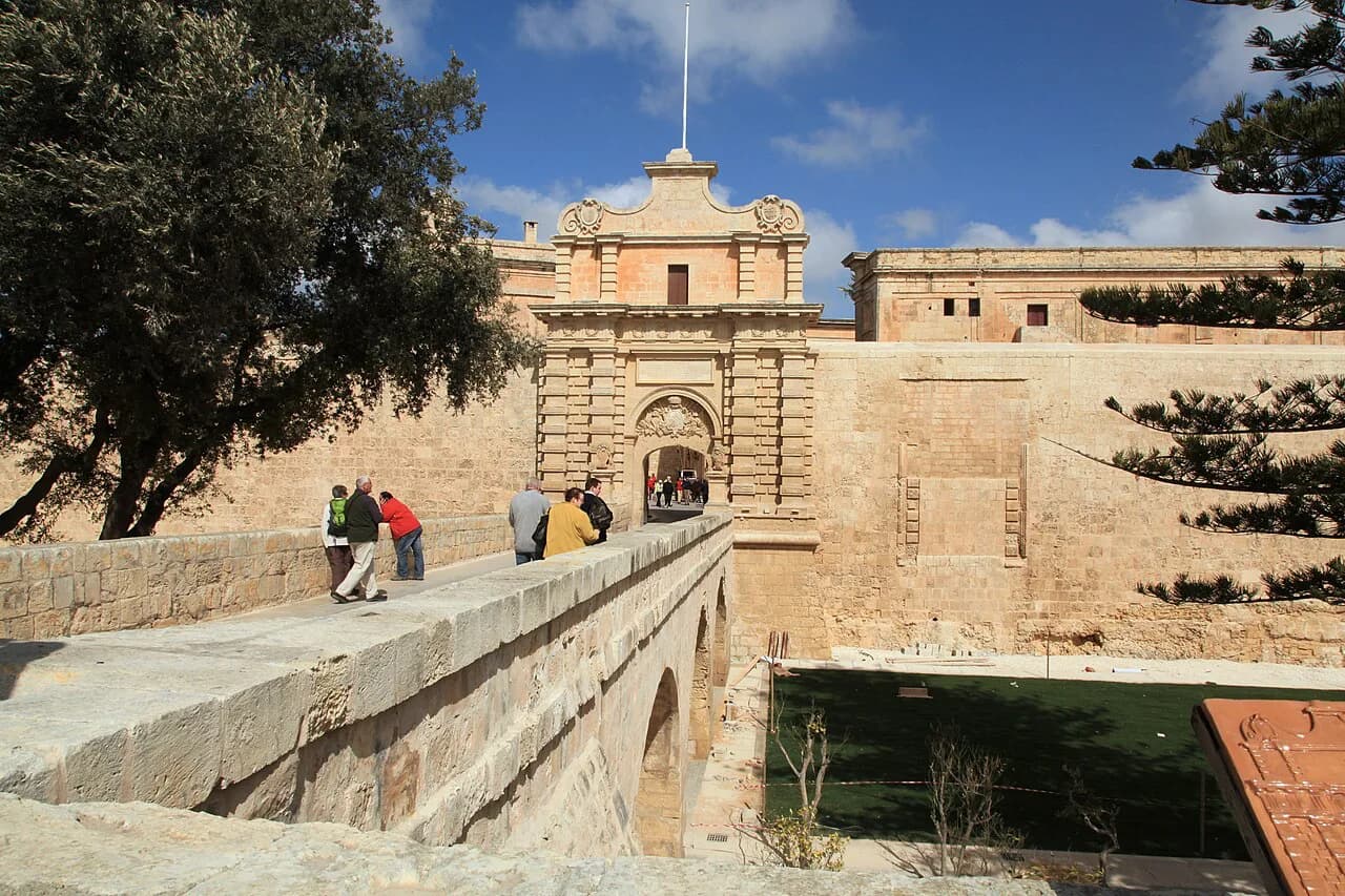
Most visitors arrive on foot from Rabat, and the walk brings you to Mdina Gate, the main entrance into the walled city. Put that gate at the top of your mental map: everything else inside is found by walking through it and on.
Buses stop outside the walls rather than inside, so the last stretch is always walked. If you are planning the day around this entry point, the wider set of things to do in Mdina helps you decide how long to allow once you are through the gate.
Coming by car, plan to leave it outside the fortifications and walk up to the gate rather than expecting to drive within the walls. Arriving on foot from Rabat tends to be busiest in the middle of the day.
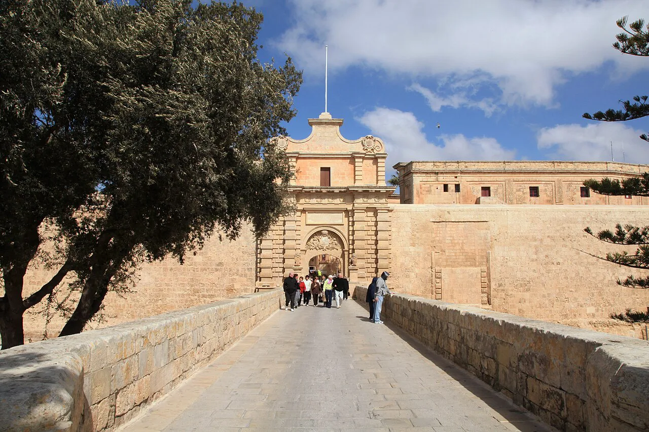
Orientation inside the walls: the main street running from the gate towards the far side of the city
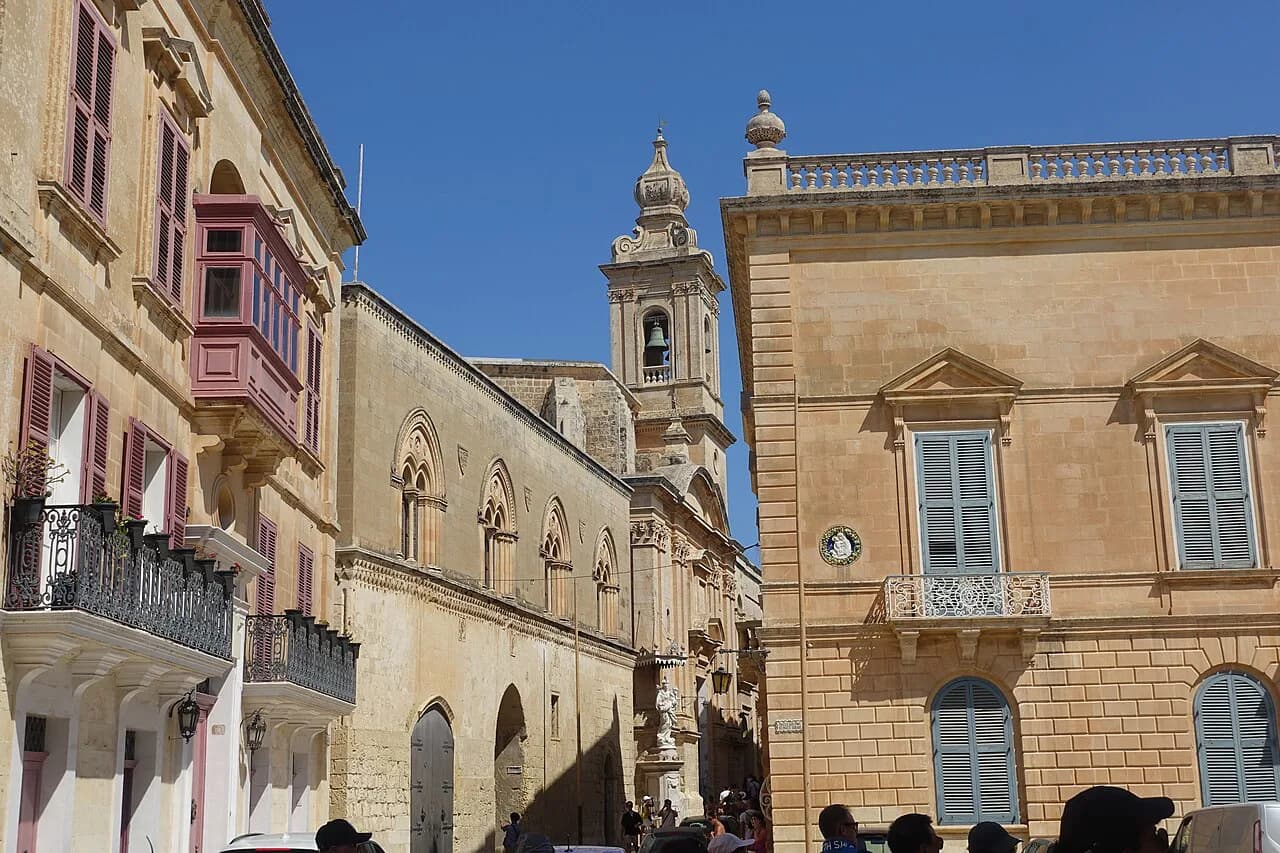
Once through Mdina Gate, the simplest orientation is to follow the main street away from the gate and towards the far side of the city. Side lanes branch off it, and the squares open up along the way rather than sitting in a neat grid.
The lanes are narrow, shaded in places and easy to wander without a plan, which is part of the appeal. If you would rather have the route worked out in advance, a Mdina walking tour covers the same ground with the street pattern explained as you go.
For a closer look at what the individual lanes offer, the guide to Mdina streets picks out the detail that a small-scale plan cannot show.
The walls: where the viewing points sit on the map and how far they are from the gate
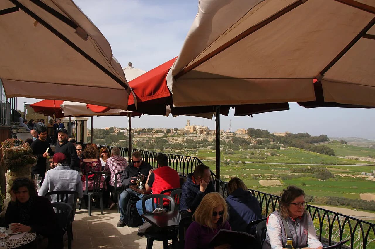
The wall circuit forms the outer edge of any Mdina map, and the viewing points sit along that edge looking out over the island. Because the city is compact, the walk from the gate to the walls is short, but the open ground along the fortifications is where you will want to linger.
A Michelin map of Mdina is a printed option for seeing the town plan before you arrive.
The wall views are the main reason to keep the map open after you have found your bearings: once you know which edge of the city you are on, the orientation of the whole island falls into place.
Mdina or Rabat: which side of the boundary your map is showing
Mdina and Rabat run into each other on foot, and many maps blur the boundary between the walled city and the town outside its walls. Where the fortifications end and Rabat begins is worth knowing, because the two are often visited in the same walk.
If you want to extend the day beyond the gate, the guide to things to do in Rabat Malta covers the sights on the outside of the walls, which sit within easy walking distance of the approach to Mdina.
A simple map service that plots Mdina with nearby places can help you see how the walled city relates to the settlements around it before you set out.
Map-based walking plan: a loop from the gate, through the streets, out to the walls and back
The most practical plan is a loop: enter at Mdina Gate, follow the main street through the city, work your way out to the walls for the views, then return through the lanes to the gate. Leave plenty of time if you stop at churches, palaces or a café.
The times are rough guidance rather than measured figures, and they stretch when the streets are busy. If you would rather follow a set route than improvise the loop, the guide to the history of Mdina adds context to what you are walking past.
Plan the loop away from the strongest midday sun if you want to linger on the walls, and keep the map in hand at the point where the lanes converge back towards the gate.
Arriving by bus or car: where the stops and parking sit relative to the gate on a map
On the map, the bus stops and car parks sit on the Rabat side of the fortifications, outside the gate rather than within the walls. Arrival is therefore followed by a short walk up to the entrance.
Inside the walls there is no driving, so the position of parking matters mainly for the walk up to the gate. Look at the approach from Rabat on the plan before you travel so you know which side of the walls you will be arriving from.
Bus numbers, timetables and car-park charges change, so check them with the operator before you set out rather than relying on a printed plan.
What to fold into the same walk: churches and palaces on the plan, and Rabat just outside
The churches, palaces and museums inside the walls appear on a decent town plan, and each adds time to the loop. Pick the ones you want before you walk in, because deciding on the spot at every doorway eats into the time you have on the walls.
If you want a shortlist rather than the whole plan, the Mdina Attractions collection groups the individual sights so you can choose before you arrive.
Outside the walls, Rabat's sights sit just beyond the gate on the same plan, which makes them easy to add to the end of the walk.
Whether the detour is worth your time depends on how much you want from a single day; a candid look at whether Mdina is worth visiting is useful for setting expectations before you commit the hours.
Reading the map before you go: what the plan will not tell you
A plan shows streets and walls but not crowds, heat or which lanes are shaded at which hour. Mdina is small enough that a map is for orientation and wall viewpoints, not for navigating between distant sights.
Use the map to set the gate, the main street and the wall edge, and leave the rest to the walk. If you want to see what the individual sights offer before you decide, the guide to Things to Do in Mdina gives you the detail the plan lacks.
The VisitMalta page on Mdina sets the city in its wider context for anyone planning time in Malta, and it is worth a quick read before you fix your day.
Build your Mdina walk around the gate and the walls
Plan the day around two fixed points on the map: Mdina Gate for arrival and the wall edge for the views. Between them, the main street and the side lanes are short enough to explore without a route, with the option to add Rabat on the walk back out.
Use the plan to decide what you want to see inside the walls, then put the map away and let the city's small scale do the rest.
Explore more Mdina guides
Frequently Asked Questions
Where is Mdina on a map of Malta?
Mdina sits inland in the centre of Malta, enclosed by fortifications and reached through its gates. On a map of the island it is away from the coastal harbours around Valletta, and on foot it runs into Rabat on the outside of the walls.
Do you need a map to walk around Mdina?
Not for navigation, because the walled city is small and a loop from the gate out to the walls is short. A map helps with orientation: working out where the wall viewpoints sit and knowing which side of the walls your bus stop or parking is on.
Is Mdina Gate the usual way in?
Yes. Mdina Gate is the main entrance to the walled city and the point where the walk up from Rabat and the bus stops bring most visitors. Buses stop outside the walls, so the last stretch is always on foot.
Can you see Mdina and Rabat on the same map?
Yes. The two run into each other on foot, and the boundary between the walled city and Rabat falls at the fortifications. Some plans blur that line, so look for where the walls end to see which side you are on.
Sources
Notes for your Malta trip
Optional updates when we add or correct a Malta or Gozo guide.
You might also like

Continue reading
More guides you'll find useful